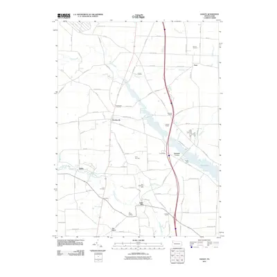
2010 Map of Hadley
USGS Topo · Published 2010About this map
Sheakleyville and Hadley anchor this western Pennsylvania landscape, where the waters of the Little Shenango River and Sandy Creek cut through the terrain. The creation of the Pine Run Dam formed the expansive Lake Wilhelm, which dominates the eastern portion of the map and significantly altered the local geography. This 2010 survey shows the area's transition into a recreational and residential corridor, evidenced by Camp Wilhelm and the Marina Boat Launch on the lake's shores.
Find a feature on this map
93 named features on this map. Tap any name to fly to it.
Don’t see what you’re looking for? This feature index may not catch every label — zoom into the map to look around manually.
Map Details
Editions of this 2010 Hadley Map
This is the sole edition of this map. No revisions or reprints were ever made.
Other maps of this area

1906 · Linesville
USGS Topo · 1:62,500

1908 · Shenango
USGS Topo · 1:62,500

1908 · Linesville
USGS Topo · 1:62,500

1911 · Stoneboro
USGS Topo · 1:62,500

1913 · Stoneboro
USGS Topo · 1:62,500

1923 · Meadville
USGS Topo · 1:62,500

1925 · Meadville
USGS Topo · 1:62,500

1943 · Meadville
USGS Topo · 1:62,500

1943 · Stoneboro
USGS Topo · 1:62,500

1950 · Cleveland
USGS Topo · 1:250,000
Featured Places
- New Vernon Township, PA
- Sheakleyville, PA
- Perry Township, PA
- Clarks Mills, Perry Township
- McQuiston Corners, Deer Creek Township