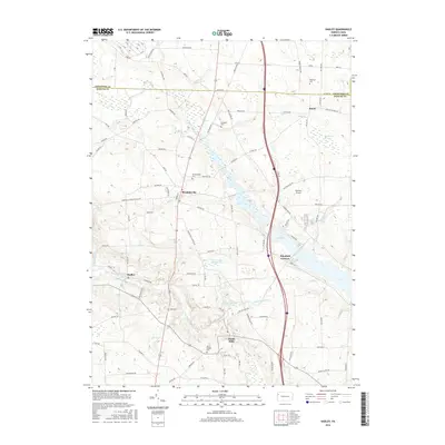
2016 Map of Hadley
USGS Topo · Published 2016About this map
Sheakleyville and Hadley anchor this portion of the northwestern Pennsylvania landscape along the borders of Mercer and Crawford Counties. The geography is defined by the significant footprint of Lake Wilhelm, which fills much of the central valley and is supported by the Pine Run Dam Sediment Pond. To the south, the Little Shenango River and the Little Shenango Dam Reservoir shape the topography near Clarks Mills. This 2016 survey captures a rural network of cemeteries and small crossroads, including Peterson Cem near Sunol and the Sheakleyville Cem. The presence of Fletcher Airport and the natural expanse of Cranberry Swamp reflect a landscape that balances specialized infrastructure with the region’s native wetlands and stream systems like Sandy Cr and Black Run.
Find a feature on this map
109 named features on this map. Tap any name to fly to it.
Don’t see what you’re looking for? This feature index may not catch every label — zoom into the map to look around manually.
Map Details
Editions of this 2016 Hadley Map
This is the sole edition of this map. No revisions or reprints were ever made.
Other maps of this area

1906 · Linesville
USGS Topo · 1:62,500

1908 · Shenango
USGS Topo · 1:62,500

1908 · Linesville
USGS Topo · 1:62,500

1911 · Stoneboro
USGS Topo · 1:62,500

1913 · Stoneboro
USGS Topo · 1:62,500

1923 · Meadville
USGS Topo · 1:62,500

1925 · Meadville
USGS Topo · 1:62,500

1943 · Meadville
USGS Topo · 1:62,500

1943 · Stoneboro
USGS Topo · 1:62,500

1950 · Cleveland
USGS Topo · 1:250,000
Featured Places
- New Vernon Township, PA
- Sheakleyville, PA
- Perry Township, PA
- Clarks Mills, Perry Township
- McQuiston Corners, Deer Creek Township