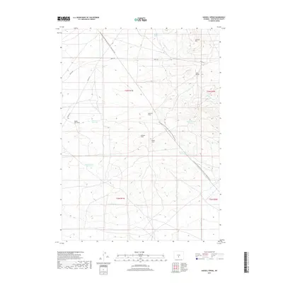
2017 Map of Hadsell Spring
USGS Topo · Published 2017About this map
Hadsell Spring and the drainage of Lost Soldier Cr define this high-altitude landscape in Sweetwater County. The map documents the route of the Continental Divide National Scenic Trail, which snakes through the undulating terrain past features like Osborne Draw and Stratton Draw. The regional water management is evident in the scattered catchments such as Dry Well Reservoir and Pinnacle Springs Reservoir, supporting livestock or local wildlife in an arid environment. Transportation across this portion of the Red Desert relies on the established Bairoil Rd and several Bureau of Land Management routes like BLM Rd 3215. Significant geological landmarks including Stratton Rim and the Twin Buttes provide essential orientation points for those navigating this expansive segment of the Great Divide.
Find a feature on this map
20 named features on this map. Tap any name to fly to it.
Don’t see what you’re looking for? This feature index may not catch every label — zoom into the map to look around manually.
Map Details
Editions of this 2017 Hadsell Spring Map
This is the sole edition of this map. No revisions or reprints were ever made.
Other maps of this area

1955 · Casper
USGS Topo · 1:250,000

1958 · Casper
USGS Topo · 1:250,000

1960 · Sooner Reservoir
USGS Topo · 1:24,000

1960 · Bull Springs
USGS Topo · 1:24,000

1960 · Chicken Spring
USGS Topo · 1:24,000
1961 · Osborne Well
USGS Topo · 1:24,000

1961 · Hadsell Spring
USGS Topo · 1:24,000

1961 · Crooks Peak
USGS Topo · 1:24,000

1961 · Bairoil
USGS Topo · 1:24,000

1962 · Casper
USGS Topo · 1:250,000