
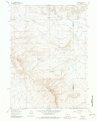
1961 Map of Bairoil
USGS Topo · Published 1966About this map
Bairoil and its surrounding energy infrastructure define the landscape of the Wyoming high desert during the early 1960s. This survey, following the border of Sweetwater and Carbon counties, illustrates a specialized industrial settlement built around a concentrated Oil Field. Beyond the central townsite, company outposts like South Camp and Wertz Camp sit alongside utility infrastructure, including a network of pipelines, pumping stations, and a high-elevation Landing Field.
Find a feature on this map
28 named features on this map. Tap any name to fly to it.
Don’t see what you’re looking for? This feature index may not catch every label — zoom into the map to look around manually.
Map Details
Editions of this 1961 Bairoil Map
2 editions found
Other maps of this area

1955 · Casper
USGS Topo · 1:250,000

1958 · Casper
USGS Topo · 1:250,000

1960 · Separation Rim
USGS Topo · 1:24,000

1960 · Bull Springs
USGS Topo · 1:24,000

1960 · Chicken Spring
USGS Topo · 1:24,000

1961 · Lamont
USGS Topo · 1:24,000

1961 · Hadsell Spring
USGS Topo · 1:24,000

1962 · Casper
USGS Topo · 1:250,000

1962 · Whiskey Peak
USGS Topo · 1:24,000
1962 · Sagebrush Park
USGS Topo · 1:24,000