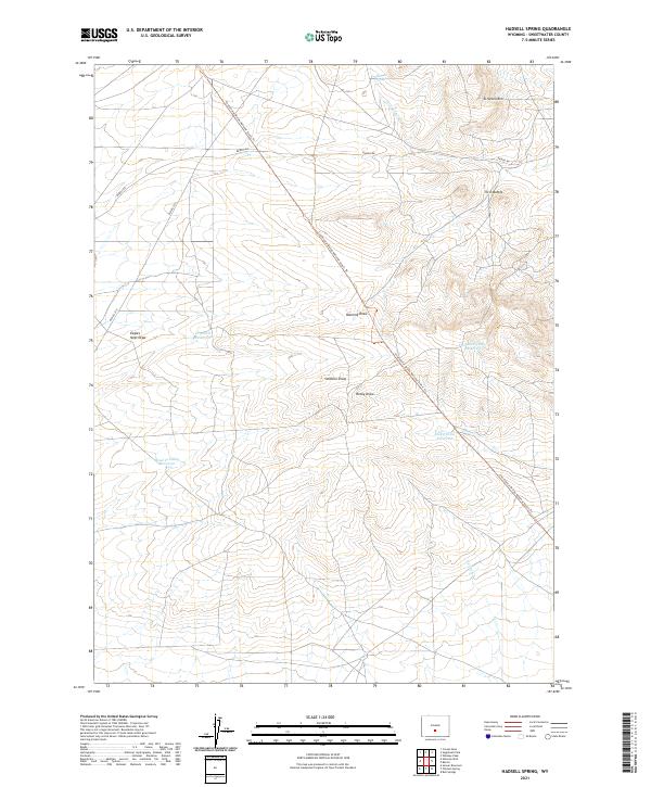
2021 Map of Hadsell Spring
USGS Topo · Published 2021About this map
Continental Divide National Scenic Trl cuts a diagonal path through this corner of Sweetwater County, tracking the high ground across a landscape defined by seasonal drainages and stock water improvements. The map reveals a sophisticated network of water management in a semi-arid environment, with named catchments like Pinnacle Springs Reservoir, Dry Well Reservoir, and Rocky Draw Reservoir providing essential resources for livestock and wildlife. These features, along with Hadsell Spring and Lost Soldier Cr, illustrate the fundamental importance of water rights and hydrology in Wyoming's high desert. Notable topographic landmarks such as Stratton Rim and the Twin Buttes offer orientation points for those traversing the remote Bairoil Rd or BLM Rd 3215. This survey documents a working landscape where the lines of the Public Land Survey System intersect with ancient geography.
Find a feature on this map
20 named features on this map. Tap any name to fly to it.
Don’t see what you’re looking for? This feature index may not catch every label — zoom into the map to look around manually.
Map Details
Editions of this 2021 Hadsell Spring Map
This is the sole edition of this map. No revisions or reprints were ever made.
Other maps of this area

1955 · Casper
USGS Topo · 1:250,000

1958 · Casper
USGS Topo · 1:250,000

1960 · Sooner Reservoir
USGS Topo · 1:24,000

1960 · Bull Springs
USGS Topo · 1:24,000

1960 · Chicken Spring
USGS Topo · 1:24,000
1961 · Osborne Well
USGS Topo · 1:24,000

1961 · Hadsell Spring
USGS Topo · 1:24,000

1961 · Crooks Peak
USGS Topo · 1:24,000

1961 · Bairoil
USGS Topo · 1:24,000

1962 · Casper
USGS Topo · 1:250,000