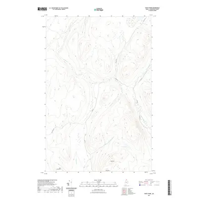
2021 Map of Hafey Pond
USGS Topo · Published 2021About this map
Hafey Pond sits at the center of this remote northern Maine landscape, where the headwaters of numerous drainages begin their descent through the North Woods. The terrain is defined by prominent elevations such as Hafey Mtn and Boat Landing Mtn, which overlook a dense network of watercourses including Yanketuladi Brook and Dead Brook.
Find a feature on this map
13 named features on this map. Tap any name to fly to it.
Don’t see what you’re looking for? This feature index may not catch every label — zoom into the map to look around manually.
Map Details
Editions of this 2021 Hafey Pond Map
This is the sole edition of this map. No revisions or reprints were ever made.
Other maps of this area

1930 · Allagash
USGS Topo · 1:48,000

1933 · Allagash
USGS Topo · 1:62,500

1955 · Rocky Mountain
USGS Topo · 1:62,500

1955 · Rocky Brook
USGS Topo · 1:62,500

1955 · Beau Lake
USGS Topo · 1:62,500

1962 · Edmundston
USGS Topo · 1:250,000
1986 · Landry
USGS Topo · 1:24,000

1987 · Beau Lake
USGS Topo · 1:24,000
1987 · Johnson Brook Mountain
USGS Topo · 1:24,000

1987 · Hafey Pond
USGS Topo · 1:24,000