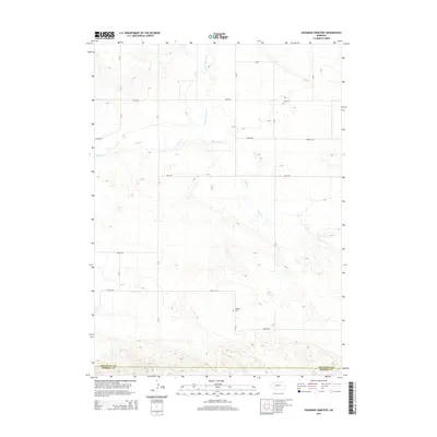
2014 Map of Hagaman Cemetery
USGS Topo · Published 2014About this map
Hagaman Cem serves as a primary historical marker in this rural landscape of Box Butte County, situated just north of the county line shared with Morrill County. The terrain is defined by the winding paths of Point of Rocks Cr and Snake Cr, which carve through the high plains. A rigid grid of section-line roads, including Otoe Rd, Perkins Rd, and Valley Rd, organizes the agricultural territory. This 2014 survey documents the enduring spatial layout of the Nebraska Panhandle, where transport routes and local landmarks remain tied to the area's early settlement patterns. The map highlights the intersection of natural watercourses and the human-imposed township and range system, providing a clear view of the ranching and farming infrastructure near the southern border of Box Butte Co.
Find a feature on this map
15 named features on this map. Tap any name to fly to it.
Don’t see what you’re looking for? This feature index may not catch every label — zoom into the map to look around manually.
Map Details
Editions of this 2014 Hagaman Cemetery Map
This is the sole edition of this map. No revisions or reprints were ever made.
Other maps of this area

1896 · Browns Creek
USGS Topo · 1:125,000

1898 · Camp Clarke
USGS Topo · 1:125,000

1899 · Browns Creek
USGS Topo · 1:125,000

1947 · Bronco Lake
USGS Topo · 1:24,000

1948 · Hemingford 4 SW
USGS Topo · 1:24,000

1948 · Hemingford 4 SE
USGS Topo · 1:24,000

1948 · Berea Creek West
USGS Topo · 1:24,000

1948 · Hemingford 4 NE
USGS Topo · 1:24,000

1948 · Hemingford 4 NW
USGS Topo · 1:24,000

1949 · Lynn
USGS Topo · 1:62,500