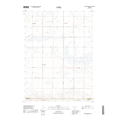
2017 Map of Hagaman Cemetery
USGS Topo · Published 2017About this map
Hagaman Cem serves as a central landmark in this high plains landscape, situated near the intersection of Co Rd 69 and Wayne Rd. The terrain is defined by a series of seasonal wetlands and drainage systems, most notably the winding course of Snake Cr and Point of Rocks Cr. The map details the rural grid of the Nebraska Panhandle, following the section lines of Township 24 North and Township 25 North. This survey captures the transition between Box Butte Co and Morrill Co to the south, illustrating a landscape primarily organized for agricultural movement via roads such as Perkins Rd, Valley Rd, and Otoe Rd.
Find a feature on this map
22 named features on this map. Tap any name to fly to it.
Don’t see what you’re looking for? This feature index may not catch every label — zoom into the map to look around manually.
Map Details
Editions of this 2017 Hagaman Cemetery Map
This is the sole edition of this map. No revisions or reprints were ever made.
Other maps of this area

1896 · Browns Creek
USGS Topo · 1:125,000

1898 · Camp Clarke
USGS Topo · 1:125,000

1899 · Browns Creek
USGS Topo · 1:125,000

1947 · Bronco Lake
USGS Topo · 1:24,000

1948 · Hemingford 4 SW
USGS Topo · 1:24,000

1948 · Hemingford 4 SE
USGS Topo · 1:24,000

1948 · Berea Creek West
USGS Topo · 1:24,000

1948 · Hemingford 4 NE
USGS Topo · 1:24,000

1948 · Hemingford 4 NW
USGS Topo · 1:24,000

1949 · Lynn
USGS Topo · 1:62,500