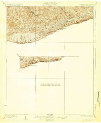
1932 Map of Hagan
USGS Topo · Published 1932About this map
Cumberland Mountain forms a massive natural wall between Kentucky and Virginia on this 1926 survey, showing a landscape defined by sharp ridges and deep mountain gaps. The drainage of Martins Fork and the Cumberland River dictates the placement of small communities like Alva and Liggett in the valley floors. These settlements relied on narrow passes such as Middleton Gap and Brittain Gap to maintain connection across the high ridges of Brush Mountain. The map reveals the rural infrastructure of the early 20th century, marking local gathering points like Hensley Store and schools including Hensley Sch and Upper Martins Fork Sch. Large landmarks like White Rocks and Notch Rock served as vital navigational points for those traversing the high ground between Harlan and Lee counties.
Find a feature on this map
42 named features on this map. Tap any name to fly to it.
Don’t see what you’re looking for? This feature index may not catch every label — zoom into the map to look around manually.
Map Details
Editions of this 1932 Hagan Map
3 editions found

Other maps of this area

1883 · Morristown
USGS Topo · 1:125,000

1886 · Cumberland Gap
USGS Topo · 1:125,000

1887 · Jonesville
USGS Topo · 1:125,000

1888 · Cumberland Gap
USGS Topo · 1:125,000

1891 · Cumberland Gap
USGS Topo · 1:125,000

1891 · Jonesville
USGS Topo · 1:125,000

1893 · Morristown
USGS Topo · 1:125,000

1895 · Morristown
USGS Topo · 1:125,000

1897 · Maynardville
USGS Topo · 1:125,000

1900 · Maynardville
USGS Topo · 1:125,000