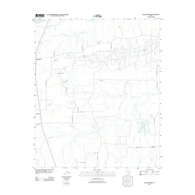
2013 Map of Hagansport
USGS Topo · Published 2013About this map
Hagansport serves as a central point of settlement in this part of Franklin County, situated near the intersection of FM-71 and the Sulphur River valley. The landscape is defined by a dense network of local county roads, such as CO Road NW 1028 and CO Road NE 2130, which connect scattered homesteads and small agricultural communities like Lakeview and Daphne. For genealogists and local historians, the presence of several established burial grounds provides significant research value, including the Hagansport Cemetery, the Prairie Acad Cemetery, and the Murphy Cemetery.
Find a feature on this map
34 named features on this map. Tap any name to fly to it.
Don’t see what you’re looking for? This feature index may not catch every label — zoom into the map to look around manually.
Map Details
Editions of this 2013 Hagansport Map
This is the sole edition of this map. No revisions or reprints were ever made.
Other maps of this area

1953 · Texarkana
USGS Topo · 1:250,000

1956 · Texarkana
USGS Topo · 1:250,000

1963 · Mitchell Creek
USGS Topo · 1:24,000

1963 · Cunningham
USGS Topo · 1:24,000

1964 · Mount Vernon
USGS Topo · 1:24,000

1964 · Cuthand
USGS Topo · 1:24,000

1964 · Saltillo
USGS Topo · 1:24,000

1964 · Talco
USGS Topo · 1:24,000

1964 · Hagansport
USGS Topo · 1:24,000

1964 · Bogata
USGS Topo · 1:24,000