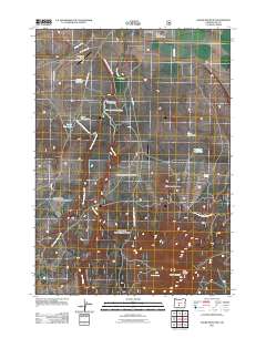
2011 Map of Hager Mountain
USGS Topo · Published 2011About this map
Silver Lake serves as the focal point for this high-desert landscape in Lake County, where water management is central to the local economy and ecology. The map documents a sophisticated network of resource infrastructure, including the Silver Creek Diversion Dam and the Silver L I D Reservoir, which regulate the flow of the West Fork Silver Creek. Evidence of federal land management and aviation history is scattered throughout the terrain, from the Silver Lake Forest Service Strip and Red and White Airport in the north to the Chase Spring Administrative Study Plot further south. High elevation points like Mahogany Mountain and the Hager Mountain Lookout provide vantage points over a region defined by scattered water sources like Blow Waterhole and Hager Spring, illustrating the critical nature of water rights and livestock grazing on the Gowdy Ranch and surrounding range.
Find a feature on this map
28 named features on this map. Tap any name to fly to it.
Don’t see what you’re looking for? This feature index may not catch every label — zoom into the map to look around manually.
Map Details
Editions of this 2011 Hager Mountain Map
This is the sole edition of this map. No revisions or reprints were ever made.
Other maps of this area

1889 · Klamath
USGS Topo · 1:250,000

1894 · Klamath
USGS Topo · 1:250,000

1955 · Crescent
USGS Topo · 1:250,000

1955 · Klamath Falls
USGS Topo · 1:250,000

1957 · Crescent
USGS Topo · 1:250,000

1958 · Crescent
USGS Topo · 1:250,000

1958 · Klamath Falls
USGS Topo · 1:250,000

1960 · Sycan Marsh
USGS Topo · 1:62,500

1966 · Foster Butte
USGS Topo · 1:24,000

1968 · Silver Lake
USGS Topo · 1:24,000