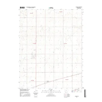
2016 Map of Haggard
USGS Topo · Published 2016About this map
Haggard stands as a focal point in this portion of Gray County, situated along the southern edge of a landscape defined by a rigid grid of rural roads and section lines. The settlement’s position at the intersection of Z Rd and Co Rd 19 reflects the systematic organization of the High Plains, where transportation routes follow the cardinal directions with precision. This 2016 survey illustrates the endurance of the township and range system, showing how major thoroughfares like S Rd and T Rd partition the agricultural terrain into a predictable network of miles.
Find a feature on this map
22 named features on this map. Tap any name to fly to it.
Don’t see what you’re looking for? This feature index may not catch every label — zoom into the map to look around manually.
Map Details
Editions of this 2016 Haggard Map
This is the sole edition of this map. No revisions or reprints were ever made.
Other maps of this area

1892 · Dodge
USGS Topo · 1:125,000

1955 · Dodge City
USGS Topo · 1:250,000

1958 · Dodge City
USGS Topo · 1:250,000

1959 · Dodge City
USGS Topo · 1:250,000

1968 · Montezuma
USGS Topo · 1:24,000

1968 · Ingalls
USGS Topo · 1:24,000

1968 · Montezuma NW
USGS Topo · 1:24,000

1968 · Cimarron
USGS Topo · 1:24,000
1968 · Dodge City SW
USGS Topo · 1:24,000
1969 · Haggard
USGS Topo · 1:24,000