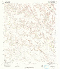
1969 Map of Hagler Canyon
USGS Topo · Published 1972About this map
Deep drainage networks including Whitely Canyon and Hagler Canyon dominate this landscape on the border of Terrell and Brewster Counties. The 1969 field-checked survey reveals a remote West Texas terrain defined by erosion and seasonal water management, where isolated Water Tanks and a Well represent the vital infrastructure for ranching and transit. The Southern Pacific railroad cuts through the northeastern corner, following the natural contours near Putman Canyon. This transit corridor highlights the historical reliance on natural gaps and canyons to navigate the Trans-Pecos region. Smaller tributaries like Isinglass Canyon and Washboard Canyon feed into larger systems, illustrating the complex topography encountered by surveyors and early travelers in this arid environment.
Find a feature on this map
11 named features on this map. Tap any name to fly to it.
Don’t see what you’re looking for? This feature index may not catch every label — zoom into the map to look around manually.
Map Details
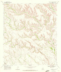
Editions of this 1969 Hagler Canyon Map
2 editions found
Other maps of this area

1918 · Bullis Gap
USGS Topo · 1:62,500

1918 · Indian Wells
USGS Topo · 1:62,500

1920 · Longfellow
USGS Topo · 1:125,000

1928 · Sanderson
USGS Topo · 1:125,000

1954 · Fort Stockton
USGS Topo · 1:250,000

1958 · Fort Stockton
USGS Topo · 1:250,000

1959 · Emory Peak
USGS Topo · 1:250,000

1965 · Emory Peak
USGS Topo · 1:250,000

1968 · Big Brindle Canyon
USGS Topo · 1:24,000

1968 · Ninemile Ranch
USGS Topo · 1:24,000