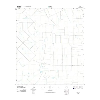
2010 Map of Hahn
USGS Topo · Published 2010About this map
Hahn and its surrounding coastal prairie landscape are defined by a sophisticated network of seasonal drainages and local roads. This area of Wharton County features a dense concentration of creeks, including the southward-flowing Pinoak Creek, West Mustang Creek, and Porters Creek. These watercourses dictate the placement of local thoroughfares like FM 1160 and FM 2546 RD, which intersect at the small settlement of Hahn.
Find a feature on this map
29 named features on this map. Tap any name to fly to it.
Don’t see what you’re looking for? This feature index may not catch every label — zoom into the map to look around manually.
Map Details
Editions of this 2010 Hahn Map
This is the sole edition of this map. No revisions or reprints were ever made.
Other maps of this area

1953 · Seguin
USGS Topo · 1:250,000

1958 · Seguin
USGS Topo · 1:250,000

1959 · Garwood
USGS Topo · 1:24,000

1959 · Bonus
USGS Topo · 1:24,000

1960 · New Taiton
USGS Topo · 1:24,000

1965 · El Campo
USGS Topo · 1:24,000
1965 · Sheridan NE
USGS Topo · 1:24,000

1965 · Ganado NE
USGS Topo · 1:24,000

1965 · Sheridan SE
USGS Topo · 1:24,000

1965 · Gobbler Creek
USGS Topo · 1:24,000