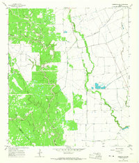
1965 Map of Sheridan NE
USGS Topo · Published 1967About this map
The Sheridan Gas Field dominates the western landscape of this mid-1960s survey, illustrating the intensive post-war industrial development in the Texas coastal plains. A complex infrastructure of gas wells, oil wells, and elevated pipelines cuts through the brush and woodlands, particularly concentrated along the winding corridors of Middle Sandy Creek and its tributaries. To the east, the terrain transitions into a more open, agricultural pattern defined by drainage systems like Pinoak Creek and Bucksnag Creek.
Find a feature on this map
15 named features on this map. Tap any name to fly to it.
Don’t see what you’re looking for? This feature index may not catch every label — zoom into the map to look around manually.
Map Details
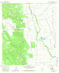
Editions of this 1965 Sheridan NE Map
2 editions found
Other maps of this area

1953 · Seguin
USGS Topo · 1:250,000

1956 · Glidden
USGS Topo · 1:62,500

1957 · Eagle Lake
USGS Topo · 1:62,500

1957 · Altair
USGS Topo · 1:24,000

1958 · Seguin
USGS Topo · 1:250,000

1959 · Garwood
USGS Topo · 1:24,000

1964 · Speaks
USGS Topo · 1:24,000

1965 · Sawmill Branch
USGS Topo · 1:24,000

1965 · Rock Island
USGS Topo · 1:24,000

1965 · Sheridan SE
USGS Topo · 1:24,000