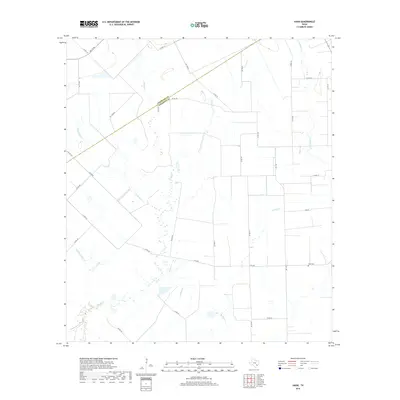
2019 Map of Hahn
USGS Topo · Published 2019About this map
The Colorado and Wharton County line cuts diagonally through this coastal prairie landscape, where the drainage patterns of numerous creeks define the rural layout. Intersecting the southeastern corner of the quadrangle, W Mustang Cr and Porters Cr flow through a region marked by agricultural fields and scattered homesteads. The Hahn Cem sits near the junction of FM 1160 and Lancer, serving as a primary local landmark for genealogical research.
Find a feature on this map
34 named features on this map. Tap any name to fly to it.
Don’t see what you’re looking for? This feature index may not catch every label — zoom into the map to look around manually.
Map Details
Editions of this 2019 Hahn Map
This is the sole edition of this map. No revisions or reprints were ever made.
Other maps of this area

1953 · Seguin
USGS Topo · 1:250,000

1958 · Seguin
USGS Topo · 1:250,000

1959 · Garwood
USGS Topo · 1:24,000

1959 · Bonus
USGS Topo · 1:24,000

1960 · New Taiton
USGS Topo · 1:24,000

1965 · El Campo
USGS Topo · 1:24,000
1965 · Sheridan NE
USGS Topo · 1:24,000

1965 · Ganado NE
USGS Topo · 1:24,000

1965 · Sheridan SE
USGS Topo · 1:24,000

1965 · Gobbler Creek
USGS Topo · 1:24,000