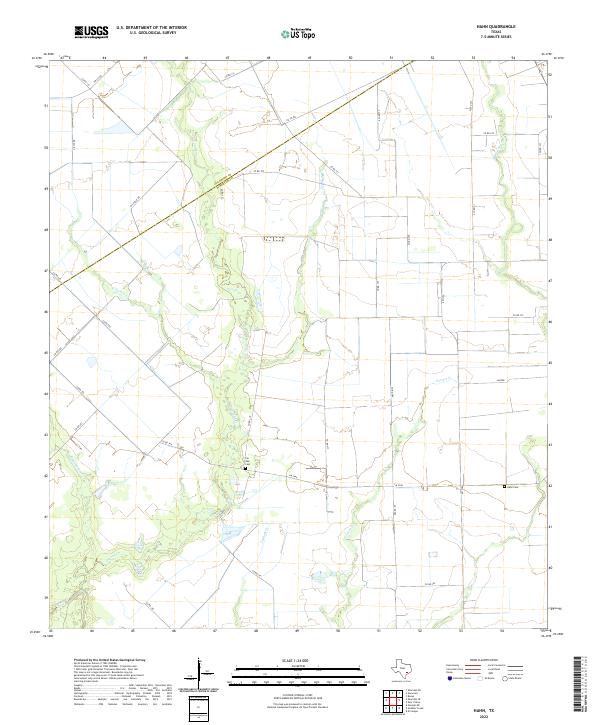
2022 Map of Hahn
USGS Topo · Published 2022About this map
The county boundary between Colorado Co and Wharton Co cuts diagonally across this Texas coastal plain landscape, defining a rural region dominated by drainage networks and farm-to-market roads. The terrain is characterized by numerous seasonal waterways, including the winding Pinoak Cr and its various tributaries like E Turkey Cr, Middle Turkey Cr, and Lookout Cr. This hydrological pattern suggests an area traditionally focused on agriculture and ranching, where land use is dictated by the flow of these creek systems toward the gulf.
Find a feature on this map
35 named features on this map. Tap any name to fly to it.
Don’t see what you’re looking for? This feature index may not catch every label — zoom into the map to look around manually.
Map Details
Editions of this 2022 Hahn Map
This is the sole edition of this map. No revisions or reprints were ever made.
Other maps of this area

1953 · Seguin
USGS Topo · 1:250,000

1958 · Seguin
USGS Topo · 1:250,000

1959 · Garwood
USGS Topo · 1:24,000

1959 · Bonus
USGS Topo · 1:24,000

1960 · New Taiton
USGS Topo · 1:24,000

1965 · El Campo
USGS Topo · 1:24,000
1965 · Sheridan NE
USGS Topo · 1:24,000

1965 · Ganado NE
USGS Topo · 1:24,000

1965 · Sheridan SE
USGS Topo · 1:24,000

1965 · Gobbler Creek
USGS Topo · 1:24,000