
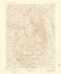
1913 Map of Hahns Peak
USGS Topo · Published 1913About this map
The Elkhorn Mine sits near the northern boundary of this 1913 survey, reflecting the mining activity that once defined this portion of the Hayden National Forest. This high-altitude landscape is characterized by the divide between Routt County and Jackson County, with the Sawtooth Range and the Continental Divide forming a natural spine across the terrain. Small settlements and isolated outposts like Columbine, Slavonia, and Clark suggest the early twentieth-century development of the region, while the presence of the Moon Hill School, Mad Creek School, and Butler School indicates established homesteading communities tucked into the valleys. Ranching footprints are evident through labels such as the Kinney Road Ranch and Boetcher Ranch. This map documents a period before modern infrastructure, where the Ute Trail and various Sawmills represent the primary modes of travel and industry across the Routt National Forest.
Find a feature on this map
105 named features on this map. Tap any name to fly to it.
Don’t see what you’re looking for? This feature index may not catch every label — zoom into the map to look around manually.
Map Details
Editions of this 1913 Hahns Peak Map
2 editions found
Other maps of this area

1906 · Medicine Bow
USGS Topo · 1:125,000

1908 · Medicine Bow
USGS Topo · 1:125,000

1911 · Hahns Peak
USGS Topo · 1:125,000

1923 · Pilot Knob
USGS Topo · 1:62,500

1924 · Mt. Harris
USGS Topo · 1:48,000

1925 · Pilot Knob
USGS Topo · 1:62,500

1926 · Mount Harris
USGS Topo · 1:62,500

1932 · Savery
USGS Topo · 1:96,000

1939 · Saratoga
USGS Topo · 1:125,000

1940 · Savery
USGS Topo · 1:125,000