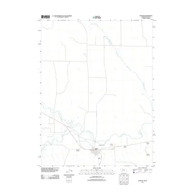
2011 Map of Haigler
USGS Topo · Published 2011About this map
Haigler occupies a critical junction in the High Plains where three watercourses converge to form the Republican River. This 2011 survey documents the town at the southwestern edge of Nebraska, positioned near the confluence of the Arikaree River and the North Fork Republican River. The landscape is defined by the broad river valley and a series of distinct drainage features cutting through the surrounding tableland, including McCann Canyon, Gilmore Canyon, and Porter Canyon. Local transit is centered on the corridor of Old Hwy 34, which parallels the river and serves the core of the village. The presence of the Haigler Post Office and the residential grid defined by Porter Ave and Logan Ave provide a clear view of the town's modern infrastructure and its historic orientation toward the river and rail path. Further north, the winding course of Buffalo Creek meanders across the plains, highlighting the subtle topography that governs water movement in this arid region.
Find a feature on this map
16 named features on this map. Tap any name to fly to it.
Don’t see what you’re looking for? This feature index may not catch every label — zoom into the map to look around manually.
Map Details
Editions of this 2011 Haigler Map
This is the sole edition of this map. No revisions or reprints were ever made.
Other maps of this area

1942 · St. Francis
USGS Topo · 1:62,500

1943 · St. Francis
USGS Topo · 1:62,500

1951 · St Francis
USGS Topo · 1:62,500

1954 · Limon
USGS Topo · 1:250,000

1954 · Sterling
USGS Topo · 1:250,000

1954 · McCook
USGS Topo · 1:250,000

1954 · Goodland
USGS Topo · 1:250,000

1956 · Goodland
USGS Topo · 1:250,000

1957 · McCook
USGS Topo · 1:250,000

1957 · Limon
USGS Topo · 1:250,000