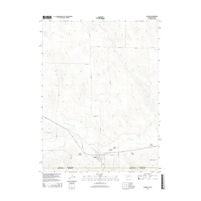
2014 Map of Haigler
USGS Topo · Published 2014About this map
Haigler serves as a central point in this tri-state border region, situated just north of the Nebraska Kansas state line. The town's grid, including S Logan Ave and S Porter Ave, is framed by the convergence of significant watercourses and deep-cut terrain. The Arikaree River flows from the west to join the North Fork Republican River, forming the main Republican River just east of the settlement. North of town, the landscape is defined by the drainage of Buffalo Cr, while the southern reaches transition into a series of named draws such as Gilmore Canyon, Carroll Canyon, and Porter Canyon. This 2014 survey documents the modern road network, from Old Highway 34 to the section-line routes like Harford Rd, that connects these remote agricultural and riparian zones.
Find a feature on this map
27 named features on this map. Tap any name to fly to it.
Don’t see what you’re looking for? This feature index may not catch every label — zoom into the map to look around manually.
Map Details
Editions of this 2014 Haigler Map
This is the sole edition of this map. No revisions or reprints were ever made.
Other maps of this area

1942 · St. Francis
USGS Topo · 1:62,500

1943 · St. Francis
USGS Topo · 1:62,500

1951 · St Francis
USGS Topo · 1:62,500

1954 · Limon
USGS Topo · 1:250,000

1954 · Sterling
USGS Topo · 1:250,000

1954 · McCook
USGS Topo · 1:250,000

1954 · Goodland
USGS Topo · 1:250,000

1956 · Goodland
USGS Topo · 1:250,000

1957 · McCook
USGS Topo · 1:250,000

1957 · Limon
USGS Topo · 1:250,000