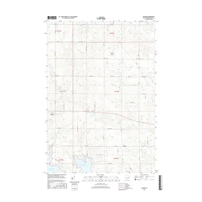
2015 Map of Halder
USGS Topo · Published 2015About this map
Halder and Moon serve as the primary landmarks in this rural Marathon County landscape, where agriculture and forestry follow the section lines of the Public Land Survey System. The southern edge of the map is defined by the expansive Big Eau Pleine Reservoir, a significant water feature that shapes local drainage and recreation. This 2015 data shows a well-established grid of county roads and town lines, including Co Rd P and Co Rd B, which connect the scattered homesteads. Tributaries like Spring Brook, Fourmile Cr, and Hog Cr meander through the terrain, illustrating the hydrologic network feeding the reservoir. A unique piece of local infrastructure is found in the northern section with the Scherrico Meadows Airport, indicating the integration of private aviation into this primarily traditional farming community.
Find a feature on this map
47 named features on this map. Tap any name to fly to it.
Don’t see what you’re looking for? This feature index may not catch every label — zoom into the map to look around manually.
Map Details
Editions of this 2015 Halder Map
This is the sole edition of this map. No revisions or reprints were ever made.
Other maps of this area

1899 · Wausau
USGS Topo · 1:125,000

1902 · Wausau
USGS Topo · 1:125,000

1902 · Marathon
USGS Topo · 1:125,000

1953 · Wausau
USGS Topo · 1:48,000

1953 · Marathon
USGS Topo · 1:48,000

1955 · Green Bay
USGS Topo · 1:250,000

1956 · Milladore
USGS Topo · 1:48,000

1956 · Stevens Point
USGS Topo · 1:48,000

1963 · Wausau West
USGS Topo · 1:24,000

1963 · Marathon
USGS Topo · 1:62,500