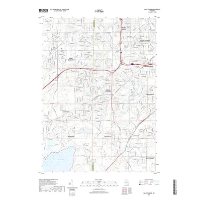
2018 Map of Hales Corners
USGS Topo · Published 2018About this map
The Waukesha and Milwaukee County line divides this landscape of suburban expansion and natural waterways. To the east, the established urban edges of West Allis, Milwaukee, and Greenfield meet the planned residential layouts of Greendale and Hales Corners. A series of natural basins, including Upper Kelly Lake and Lower Kelly Lake, provide focal points for local development, while the sprawling Muskego Lake and its adjacent Bass Bay dominate the southwestern corner. Local history is anchored by several long-standing burial grounds such as Saint-Pauls Lutheran Cem and Holy Apostles Cem. The presence of smaller, unincorporated settlements like Tess Corners and Saint Martins suggests the area's transition from older rural crossroads to modern suburban centers, connected by a dense grid of thoroughfares like W Beloit Rd and W Forest Home Ave.
Find a feature on this map
100 named features on this map. Tap any name to fly to it.
Don’t see what you’re looking for? This feature index may not catch every label — zoom into the map to look around manually.
Map Details
Editions of this 2018 Hales Corners Map
This is the sole edition of this map. No revisions or reprints were ever made.
Other maps of this area

1891 · Bayview
USGS Topo · 1:62,500

1891 · Muskego
USGS Topo · 1:62,500

1892 · Milwaukee
USGS Topo · 1:62,500

1892 · Waukesha
USGS Topo · 1:62,500

1901 · Milwaukee
USGS Topo · 1:62,500

1901 · Waukesha
USGS Topo · 1:62,500

1901 · Bayview
USGS Topo · 1:62,500

1901 · Muskego
USGS Topo · 1:62,500

1906 · Waukesha
USGS Topo · 1:62,500

1906 · Milwaukee
USGS Topo · 1:62,500