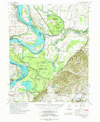
1977 Map of Hales Point
USGS Topo · Published 1977About this map
The Mississippi River dominates this mid-1970s landscape, illustrating the intricate relationship between the river's historic shifts and the tri-state border region of Tennessee, Arkansas, and Missouri. This area is characterized by massive river engineering and natural transitions, notably at the Needham Cut-Off (1821) and Wrights Point. The river’s old channels remain as sprawling oxbow lakes and wetlands, such as Open Lake, Chisholm Lake, and Swan Lake.
Find a feature on this map
96 named features on this map. Tap any name to fly to it.
Don’t see what you’re looking for? This feature index may not catch every label — zoom into the map to look around manually.
Map Details
Editions of this 1977 Hales Point Map
This is the sole edition of this map. No revisions or reprints were ever made.
Other maps of this area

1939 · Dyersburg
USGS Topo · 1:62,500

1939 · Hales Point
USGS Topo · 1:62,500

1939 · Caruthersville
USGS Topo · 1:62,500

1939 · Halls
USGS Topo · 1:62,500

1939 · Blytheville
USGS Topo · 1:62,500

1940 · Hayti
USGS Topo · 1:62,500

1951 · Caruthersville
USGS Topo · 1:62,500

1952 · Hales Point
USGS Topo · 1:62,500

1952 · Gates
USGS Topo · 1:24,000

1952 · Dyersburg
USGS Topo · 1:24,000