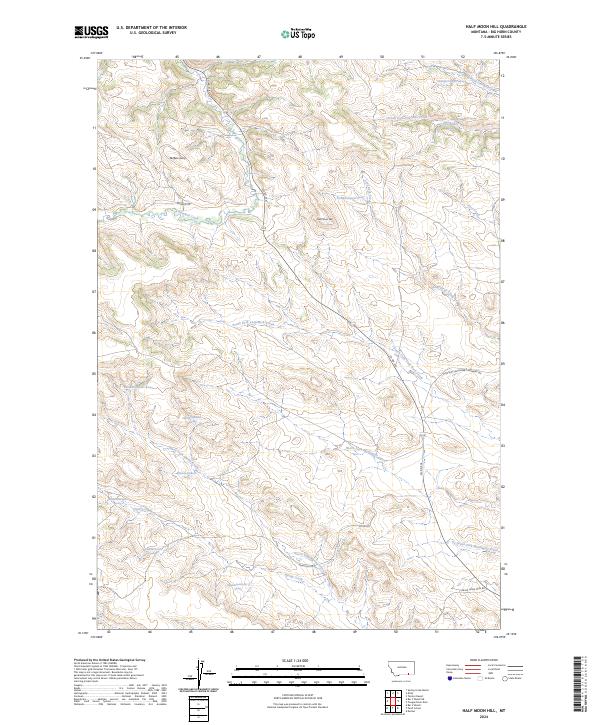
2024 Map of Half Moon Hill
USGS Topo · Published 2024About this map
Buffalo Jump stands as a prominent cultural landmark in this section of Big Horn County, marking a site of ancient significance overlooking the valley of Rosebud Creek. The landscape is defined by a complex drainage system where the South Fork Fourmile Creek and North Fork Spring Creek carve through the terrain near Half Moon Hill. This modern survey illustrates the intersection of traditional land use and contemporary infrastructure, with local routes like Hamilton Rd and the Spring Creek Mine Rd providing access across the township and range divisions. Numerous springs, such as the 07S39E23AGDD01 Spring, are documented throughout the hills, highlighting the vital role of water sources in this dry Montana environment.
Find a feature on this map
33 named features on this map. Tap any name to fly to it.
Don’t see what you’re looking for? This feature index may not catch every label — zoom into the map to look around manually.
Map Details
Editions of this 2024 Half Moon Hill Map
This is the sole edition of this map. No revisions or reprints were ever made.
Other maps of this area

1894 · Rosebud
USGS Topo · 1:125,000

1901 · Rosebud
USGS Topo · 1:125,000

1954 · Hardin
USGS Topo · 1:250,000

1957 · Hardin
USGS Topo · 1:250,000

1958 · Hardin
USGS Topo · 1:250,000

1967 · Tongue River Dam
USGS Topo · 1:24,000

1967 · Kirby
USGS Topo · 1:24,000

1967 · Bar V Ranch NE
USGS Topo · 1:24,000
1967 · Bar V Ranch
USGS Topo · 1:24,000
1967 · Pearl School
USGS Topo · 1:24,000