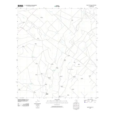
2010 Map of Halff Ranch
USGS Topo · Published 2010About this map
The Frio River snakes through this South Texas landscape, defining a region dominated by large working cattle operations and a sparse, specialized water infrastructure. Significant ranching estates like the Halff Ranch, Thompson Ranch, and the evocatively named El Rancho Quien Sabe are scattered across the terrain, connected by a network of local routes including W FM 140 and Co RD 1401.
Find a feature on this map
41 named features on this map. Tap any name to fly to it.
Don’t see what you’re looking for? This feature index may not catch every label — zoom into the map to look around manually.
Map Details
Editions of this 2010 Halff Ranch Map
This is the sole edition of this map. No revisions or reprints were ever made.
Other maps of this area

1925 · Pearsall 1-b
USGS Topo · 1:48,000

1925 · Pearsall 1-c
USGS Topo · 1:48,000

1927 · Pearsall
USGS Topo · 1:62,500

1928 · Frio Town
USGS Topo · 1:62,500

1942 · Divot
USGS Topo · 1:62,500

1953 · Crystal City
USGS Topo · 1:250,000

1954 · San Antonio
USGS Topo · 1:250,000

1955 · Crystal City
USGS Topo · 1:250,000

1956 · Divot
USGS Topo · 1:62,500

1957 · San Antonio
USGS Topo · 1:250,000