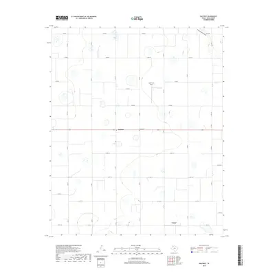
2019 Map of Halfway
USGS Topo · Published 2019About this map
Agricultural lands in the Texas Panhandle define this section of Hale County, where the small community of Halfway serves as a central point for the surrounding farming operations. The landscape is characterized by a high density of intermittent playa lakes and the north-reaching Running Water Draw. Evidence of the region's localized aviation and agribusiness history is visible through private landing strips such as Smith Farms Airport and Laney Farm Airport, which support the large-scale cultivation visible in the grid of county roads. Genealogists and local researchers will find the Halfway Cemetery situated east of the main settlement along the primary east-west corridor, providing a focal point for family history in this rural district.
Find a feature on this map
25 named features on this map. Tap any name to fly to it.
Don’t see what you’re looking for? This feature index may not catch every label — zoom into the map to look around manually.
Map Details
Editions of this 2019 Halfway Map
This is the sole edition of this map. No revisions or reprints were ever made.
Other maps of this area

1954 · Plainview
USGS Topo · 1:250,000

1954 · Clovis
USGS Topo · 1:250,000

1958 · Clovis
USGS Topo · 1:250,000

1958 · Plainview
USGS Topo · 1:250,000

1965 · Kress West
USGS Topo · 1:24,000

1965 · Edmonson
USGS Topo · 1:24,000

1965 · Hilburn
USGS Topo · 1:24,000

1965 · Wasson
USGS Topo · 1:24,000

1968 · Halfway
USGS Topo · 1:24,000
1968 · Hale Center SW
USGS Topo · 1:24,000