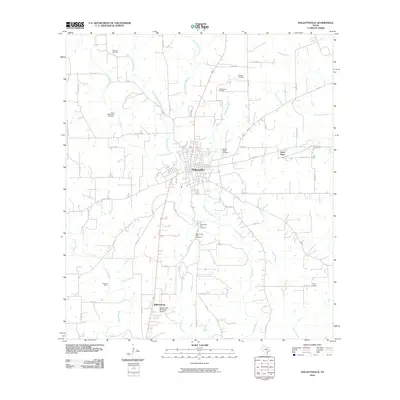
2010 Map of Hallettsville
USGS Topo · Published 2010About this map
Hallettsville serves as the central hub of this South Texas landscape, where the Lavaca River winds through a network of creeks and agricultural tracts. This 2010 survey illustrates a community deeply tied to its land and history, evidenced by the numerous burial sites such as the Pagel Settlement Cemetery and the Sacred Heart Cemetery. The presence of both the Old County Farm Cemetery and New County Farm Cemetery along the riverbanks provides a specific look at the local civic heritage of Lavaca County.
Find a feature on this map
64 named features on this map. Tap any name to fly to it.
Don’t see what you’re looking for? This feature index may not catch every label — zoom into the map to look around manually.
Map Details
Editions of this 2010 Hallettsville Map
This is the sole edition of this map. No revisions or reprints were ever made.
Other maps of this area

1901 · Flatonia
USGS Topo · 1:125,000

1919 · Schulenburg
USGS Topo · 1:62,500

1953 · Seguin
USGS Topo · 1:250,000

1958 · Seguin
USGS Topo · 1:250,000

1962 · Sublime
USGS Topo · 1:24,000

1962 · Hallettsville SE
USGS Topo · 1:24,000

1962 · Hallettsville
USGS Topo · 1:24,000

1963 · Sweet Home
USGS Topo · 1:24,000

1964 · Ezzell
USGS Topo · 1:24,000

1965 · Oakland
USGS Topo · 1:24,000