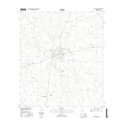
2016 Map of Hallettsville
USGS Topo · Published 2016About this map
Hallettsville sits at the heart of this East Texas survey, where the Lavaca River meanders south through a landscape of winding creeks and rural road networks. The town's grid is dense with named streets like Kahn St and Devall St, while the surrounding countryside preserves a significant genealogical record through its many burial grounds. Of particular note are the Old County Farm Cem and New County Farm Cem located south of the main settlement. Further south, the map identifies the small community of Williamsburg and the Hallettsville Municipal Airport. The drainage patterns are meticulously detailed, showing several tributaries such as Grafe Br and Rickaway Br that define the local topography. This document reflects the modern transportation and civic layout of the area, from the larger highways to the farm-to-market roads that connect the scattered family settlements and historic cemeteries.
Find a feature on this map
109 named features on this map. Tap any name to fly to it.
Don’t see what you’re looking for? This feature index may not catch every label — zoom into the map to look around manually.
Map Details
Editions of this 2016 Hallettsville Map
This is the sole edition of this map. No revisions or reprints were ever made.
Other maps of this area

1901 · Flatonia
USGS Topo · 1:125,000

1919 · Schulenburg
USGS Topo · 1:62,500

1953 · Seguin
USGS Topo · 1:250,000

1958 · Seguin
USGS Topo · 1:250,000

1962 · Sublime
USGS Topo · 1:24,000

1962 · Hallettsville SE
USGS Topo · 1:24,000

1962 · Hallettsville
USGS Topo · 1:24,000

1963 · Sweet Home
USGS Topo · 1:24,000

1964 · Ezzell
USGS Topo · 1:24,000

1965 · Oakland
USGS Topo · 1:24,000