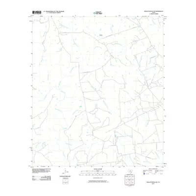
2010 Map of Hallettsville SE
USGS Topo · Published 2010About this map
The Lavaca River and Navidad River drain this rural stretch of Lavaca County, where a intricate network of creeks and branches defines the landscape. The region is marked by a complex system of county roads, such as Matula Cemetary Rd and Green Oaks Rd, which connect remote properties and historic sites. Genealogy researchers will find interest in the Haidusek Cemetery, located north of Laughlins Sandy Creek. The map documents a predominantly agrarian environment where water sources like Sandies Creek, Hardys Sandy Creek, and Bachelor Branch dictate the local geography. This survey provides a precise record of the land divisions and drainage patterns at the beginning of the twenty-first century.
Find a feature on this map
30 named features on this map. Tap any name to fly to it.
Don’t see what you’re looking for? This feature index may not catch every label — zoom into the map to look around manually.
Map Details
Editions of this 2010 Hallettsville SE Map
This is the sole edition of this map. No revisions or reprints were ever made.
Other maps of this area

1953 · Seguin
USGS Topo · 1:250,000

1958 · Seguin
USGS Topo · 1:250,000

1962 · Sublime
USGS Topo · 1:24,000

1962 · Hallettsville SE
USGS Topo · 1:24,000

1962 · Hallettsville
USGS Topo · 1:24,000

1964 · Cordele
USGS Topo · 1:24,000

1964 · Morales
USGS Topo · 1:24,000

1964 · Speaks
USGS Topo · 1:24,000

1964 · Ezzell
USGS Topo · 1:24,000

1965 · Hope
USGS Topo · 1:24,000