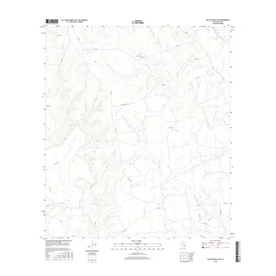
2016 Map of Hallettsville SE
USGS Topo · Published 2016About this map
The Lavaca River and Navidad River define this rural landscape in southeastern Texas, where a dense network of seasonal creeks and branches drains the coastal plain. The territory is marked by the branching headwaters of Hardys Sandy Creek, Laughlins Sandy Creek, and Sandies Creek, indicating a terrain heavily influenced by its hydrologic patterns. Local family history is centered near the Haidusek Cem and along Matula Cemetary Rd, which link the various homesteads and agricultural plots connected by a grid of county roads.
Find a feature on this map
37 named features on this map. Tap any name to fly to it.
Don’t see what you’re looking for? This feature index may not catch every label — zoom into the map to look around manually.
Map Details
Editions of this 2016 Hallettsville SE Map
This is the sole edition of this map. No revisions or reprints were ever made.
Other maps of this area

1953 · Seguin
USGS Topo · 1:250,000

1958 · Seguin
USGS Topo · 1:250,000

1962 · Sublime
USGS Topo · 1:24,000

1962 · Hallettsville SE
USGS Topo · 1:24,000

1962 · Hallettsville
USGS Topo · 1:24,000

1964 · Cordele
USGS Topo · 1:24,000

1964 · Morales
USGS Topo · 1:24,000

1964 · Speaks
USGS Topo · 1:24,000

1964 · Ezzell
USGS Topo · 1:24,000

1965 · Hope
USGS Topo · 1:24,000