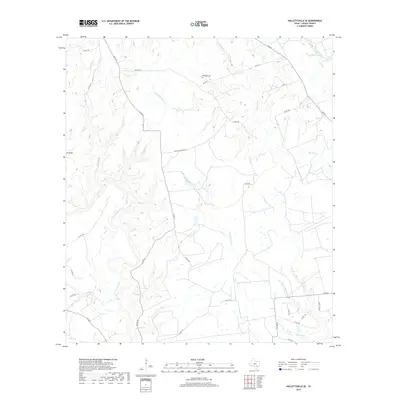
2019 Map of Hallettsville SE
USGS Topo · Published 2019About this map
The Lavaca River and its network of tributaries define the landscape of south-central Lavaca County in the late 2010s. This survey focuses on the rural lowlands between the main river channel and the Navidad River, an area characterized by complex creek systems including Hardys Sandy Cr and Sandies Cr. The land use remains primarily agricultural and pastoral, connected by a web of county roads such as Co RD 15 and Co RD 16. Local heritage is anchored by sites like the Haidusek Cem and the eponymous Matula Cemetary Rd, which provide genealogical markers for families long established in this part of Texas. From Spring Br in the northwest to the crossing of FM 530, the map illustrates a sparsely populated region where the environment is shaped by watercourses like Bachelor Br and Laughlins Sandy Cr.
Find a feature on this map
38 named features on this map. Tap any name to fly to it.
Don’t see what you’re looking for? This feature index may not catch every label — zoom into the map to look around manually.
Map Details
Editions of this 2019 Hallettsville SE Map
This is the sole edition of this map. No revisions or reprints were ever made.
Other maps of this area

1953 · Seguin
USGS Topo · 1:250,000

1958 · Seguin
USGS Topo · 1:250,000

1962 · Sublime
USGS Topo · 1:24,000

1962 · Hallettsville SE
USGS Topo · 1:24,000

1962 · Hallettsville
USGS Topo · 1:24,000

1964 · Cordele
USGS Topo · 1:24,000

1964 · Morales
USGS Topo · 1:24,000

1964 · Speaks
USGS Topo · 1:24,000

1964 · Ezzell
USGS Topo · 1:24,000

1965 · Hope
USGS Topo · 1:24,000