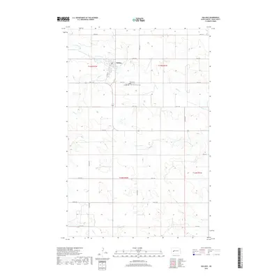
2018 Map of Halliday
USGS Topo · Published 2018About this map
Halliday serves as the central hub of this Dunn County landscape, situated near the confluence of Spring Creek and Alkali Cr. The settlement pattern reflects the grid-based township and range system, with agricultural land punctuated by several prominent religious landmarks. Southeast of the main town site, a cluster of cemeteries including Our Saviour's Lutheran Cem, Saint Pauls Lutheran Cem, and Saint Pauls Catholic Cem marks a significant local point for genealogical research. The terrain is defined by a series of drainage basins, including Cottonwood Cr and Coyote Cr, which shape the local topography. This 2018 survey captures the enduring rural character of the region, where a network of numbered section roads, from 3rd St SW down to 11th St SW, facilitates movement across the prairie hills.
Find a feature on this map
25 named features on this map. Tap any name to fly to it.
Don’t see what you’re looking for? This feature index may not catch every label — zoom into the map to look around manually.
Map Details
Editions of this 2018 Halliday Map
This is the sole edition of this map. No revisions or reprints were ever made.
Other maps of this area

1953 · Watford City
USGS Topo · 1:250,000

1957 · Watford City
USGS Topo · 1:250,000

1967 · Watford City
USGS Topo · 1:250,000

1970 · Halliday NE
USGS Topo · 1:24,000

1970 · Golden Valley NW
USGS Topo · 1:24,000

1970 · Halliday NW
USGS Topo · 1:24,000

1973 · Schaffner Creek
USGS Topo · 1:24,000

1973 · Halliday
USGS Topo · 1:24,000

1973 · Dodge
USGS Topo · 1:24,000

1973 · Werner
USGS Topo · 1:24,000