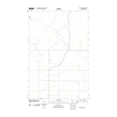
2011 Map of Halliday NE
USGS Topo · Published 2011About this map
Saint Johns Cemetery serves as a central landmark in this portion of the North Dakota landscape, situated near the intersection of several section-line roads. The area is defined by its drainage patterns, with Hans Creek meandering across the northern and eastern sections, joined by Steel Creek as it moves through the prairie. To the far south, the beginnings of Horse Creek appear, while the northwest corner is marked by the topographical depression of Hay Coulee. The map illustrates a sparse, agricultural settlement pattern where travel is dictated by a grid of local routes like Main St, 84th Ave SW, and 2nd St NW, reflecting the late 20th-century rural infrastructure before further modern developments altered the landscape.
Find a feature on this map
13 named features on this map. Tap any name to fly to it.
Don’t see what you’re looking for? This feature index may not catch every label — zoom into the map to look around manually.
Map Details
Editions of this 2011 Halliday NE Map
This is the sole edition of this map. No revisions or reprints were ever made.
Other maps of this area

1953 · Watford City
USGS Topo · 1:250,000

1957 · Watford City
USGS Topo · 1:250,000

1967 · Watford City
USGS Topo · 1:250,000

1967 · Twin Buttes
USGS Topo · 1:24,000

1970 · Halliday NE
USGS Topo · 1:24,000

1970 · Hay Flat
USGS Topo · 1:24,000

1970 · Golden Valley NW
USGS Topo · 1:24,000

1970 · Halliday NW
USGS Topo · 1:24,000
1970 · Saddle Butte SW
USGS Topo · 1:24,000

1973 · Halliday
USGS Topo · 1:24,000