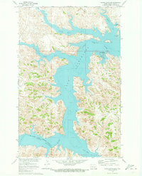
1970 Map of Saddle Butte SW
USGS Topo · Published 1973About this map
The waters of Lake Sakakawea dominate this landscape, filling the deep canyons and Coulees of Dunn County. This 1970 survey shows the Missouri River Basin project in a mature state, where the reservoir has submerged former river bottomlands to create an intricate shoreline of branching bays. The southern portion of the map is defined by the Fort Berthold Indian Reservation Boundary, while the confluence of the Little Missouri River enters from the southwest.
Find a feature on this map
18 named features on this map. Tap any name to fly to it.
Don’t see what you’re looking for? This feature index may not catch every label — zoom into the map to look around manually.
Map Details
Editions of this 1970 Saddle Butte SW Map
This is the sole edition of this map. No revisions or reprints were ever made.
Other maps of this area

1953 · Watford City
USGS Topo · 1:250,000

1957 · Watford City
USGS Topo · 1:250,000

1967 · Watford City
USGS Topo · 1:250,000

1970 · Halliday NE
USGS Topo · 1:24,000

1970 · Hay Flat
USGS Topo · 1:24,000

1970 · String Buttes
USGS Topo · 1:24,000

1970 · Halliday NW
USGS Topo · 1:24,000
1970 · Saddle Butte
USGS Topo · 1:24,000

1970 · Dunn Center NE
USGS Topo · 1:24,000

1970 · Mandaree SE
USGS Topo · 1:24,000