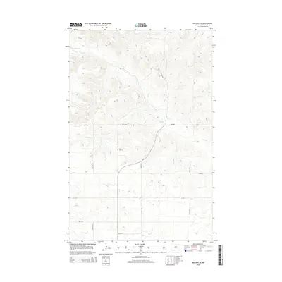
2014 Map of Halliday NE
USGS Topo · Published 2014About this map
Saint Johns Cem marks a quiet point in the landscape near the junction of 84th Ave NW and 2nd St NW, within a region defined by its undulating drainage basins. In the north, the waters of Lake Sakakawea reach into the terrain, fed by the winding course of Hans Cr. The land is further etched by Steel Cr and Horse Cr, while Hay Coulee provides a distinct topographic feature near the northern boundary. The section line road system, including routes like ND-8 and ND-1806, dictates the movement across the prairie, connecting the dispersed rural homesteads and agricultural tracts that characterize this part of Dunn County.
Find a feature on this map
22 named features on this map. Tap any name to fly to it.
Don’t see what you’re looking for? This feature index may not catch every label — zoom into the map to look around manually.
Map Details
Editions of this 2014 Halliday NE Map
This is the sole edition of this map. No revisions or reprints were ever made.
Other maps of this area

1953 · Watford City
USGS Topo · 1:250,000

1957 · Watford City
USGS Topo · 1:250,000

1967 · Watford City
USGS Topo · 1:250,000

1967 · Twin Buttes
USGS Topo · 1:24,000

1970 · Halliday NE
USGS Topo · 1:24,000

1970 · Hay Flat
USGS Topo · 1:24,000

1970 · Golden Valley NW
USGS Topo · 1:24,000

1970 · Halliday NW
USGS Topo · 1:24,000
1970 · Saddle Butte SW
USGS Topo · 1:24,000

1973 · Halliday
USGS Topo · 1:24,000