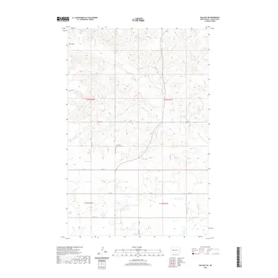
2020 Map of Halliday NE
USGS Topo · Published 2020About this map
The rolling grasslands of Dunn County are defined by a network of drainage coulees and seasonal creeks in this 2020 record of the high plains. A central landmark for local genealogy and history is the Saint John's Lutheran Cem, situated near the intersection of 84th Ave NW and Main St. The landscape is etched by several named watercourses, including Hans Cr, Steel Cr, and Hay Coulee in the north, while Horse Cr cuts through the southeastern corner. This modern survey illustrates the persistent section-line road grid, featuring routes like 2nd St NW and 81st Ave SW, which continue to organize the agricultural life and rural townships of North Dakota long after the initial homesteading era.
Find a feature on this map
18 named features on this map. Tap any name to fly to it.
Don’t see what you’re looking for? This feature index may not catch every label — zoom into the map to look around manually.
Map Details
Editions of this 2020 Halliday NE Map
This is the sole edition of this map. No revisions or reprints were ever made.
Other maps of this area

1953 · Watford City
USGS Topo · 1:250,000

1957 · Watford City
USGS Topo · 1:250,000

1967 · Watford City
USGS Topo · 1:250,000

1967 · Twin Buttes
USGS Topo · 1:24,000

1970 · Halliday NE
USGS Topo · 1:24,000

1970 · Hay Flat
USGS Topo · 1:24,000

1970 · Golden Valley NW
USGS Topo · 1:24,000

1970 · Halliday NW
USGS Topo · 1:24,000
1970 · Saddle Butte SW
USGS Topo · 1:24,000

1973 · Halliday
USGS Topo · 1:24,000