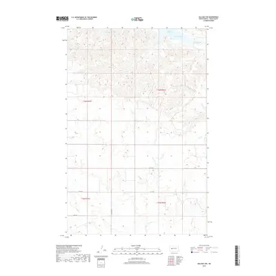
2018 Map of Halliday NW
USGS Topo · Published 2018About this map
Lake Sakakawea and the branching waters of Wolf Chief Bay dominate the northern landscape of this Dunn County region. The terrain is defined by a dense network of coulees and ridges that drain toward the reservoir, with primary watercourses like North Cr and Steel Cr carving through the prairie. The map shows the structured organization of the Public Land Survey System, highlighting the intersection of four townships including t146n r93w and t145n r92w.
Find a feature on this map
12 named features on this map. Tap any name to fly to it.
Don’t see what you’re looking for? This feature index may not catch every label — zoom into the map to look around manually.
Map Details
Editions of this 2018 Halliday NW Map
This is the sole edition of this map. No revisions or reprints were ever made.
Other maps of this area

1953 · Watford City
USGS Topo · 1:250,000

1957 · Watford City
USGS Topo · 1:250,000

1967 · Watford City
USGS Topo · 1:250,000

1970 · Halliday NE
USGS Topo · 1:24,000

1970 · Hay Flat
USGS Topo · 1:24,000

1970 · Halliday NW
USGS Topo · 1:24,000

1970 · Dunn Center NE
USGS Topo · 1:24,000

1970 · Mandaree SE
USGS Topo · 1:24,000
1970 · Saddle Butte SW
USGS Topo · 1:24,000

1973 · Halliday
USGS Topo · 1:24,000