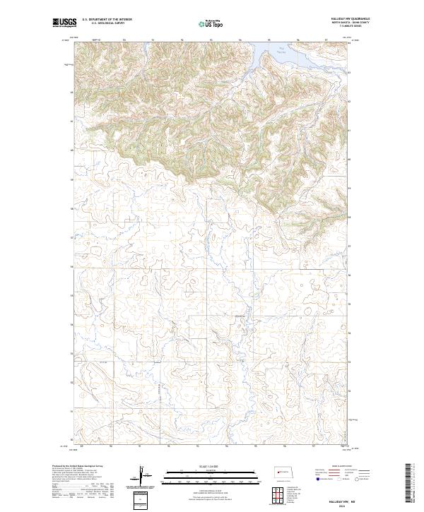
2024 Map of Halliday NW
USGS Topo · Published 2024About this map
Wolf Chief Bay defines the northern edge of this landscape, where the Missouri River system meets the high plains of Dunn County. The terrain is marked by a clear transition from the dissected draws and ridges overlooking the bay down to the expansive, grid-aligned agricultural lands to the south. This area is defined by the Public Land Survey System divisions of t146n r93w and t146n r92w, reflecting a legacy of homesteading and systematic land management. Several drainages, including North Creek and Steel Creek, cut through the prairie, providing natural focal points in an otherwise ordered landscape of section lines and gravel roads. The road network, including 1st St SW and 90th Ave SW, follows the rigid geometry of the Great Plains, connecting remote farmsteads across the undulating North Dakota topography.
Find a feature on this map
11 named features on this map. Tap any name to fly to it.
Don’t see what you’re looking for? This feature index may not catch every label — zoom into the map to look around manually.
Map Details
Editions of this 2024 Halliday NW Map
This is the sole edition of this map. No revisions or reprints were ever made.
Other maps of this area

1953 · Watford City
USGS Topo · 1:250,000

1957 · Watford City
USGS Topo · 1:250,000

1967 · Watford City
USGS Topo · 1:250,000

1970 · Halliday NE
USGS Topo · 1:24,000

1970 · Hay Flat
USGS Topo · 1:24,000

1970 · Halliday NW
USGS Topo · 1:24,000

1970 · Dunn Center NE
USGS Topo · 1:24,000

1970 · Mandaree SE
USGS Topo · 1:24,000
1970 · Saddle Butte SW
USGS Topo · 1:24,000

1973 · Halliday
USGS Topo · 1:24,000