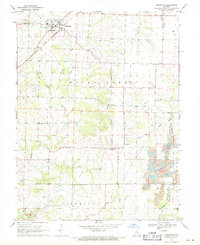
1969 Map of Hallsville
USGS Topo · Published 1971About this map
Hallsville serves as a primary hub in northern Boone County, shown here at a time when the Norfolk and Western railroad still cut through the landscape, connecting the town to the broader regional economy. The map reveals a rural community anchored by small settlements like Murry and Nelson, and defined by a network of country churches and schoolhouses. Religious and educational life is marked by sites such as Old Red Top Ch, Mt Zion Ch, and the Twomile Prairie Sch. In the southern reaches, the appearance of Strip Mines near the Columbia boundary indicates the area's transition toward industrial resource extraction. The complex hydrology of the region is evident in the winding courses of Silver Fork and Hinkson Creek, which have long shaped the local topography and settlement patterns.
Find a feature on this map
27 named features on this map. Tap any name to fly to it.
Don’t see what you’re looking for? This feature index may not catch every label — zoom into the map to look around manually.
Map Details
Editions of this 1969 Hallsville Map
2 editions found
Other maps of this area

1886 · Jefferson City
USGS Topo · 1:125,000

1890 · Moberly
USGS Topo · 1:125,000

1894 · Jefferson City
USGS Topo · 1:125,000

1917 · Sturgeon
USGS Topo · 1:62,500

1935 · Columbia
USGS Topo · 1:24,000

1940 · Columbia
USGS Topo · 1:24,000

1944 · Millersburg
USGS Topo · 1:62,500

1945 · Centralia
USGS Topo · 1:62,500

1946 · Millersburg
USGS Topo · 1:62,500

1947 · Jefferson City
USGS Topo · 1:250,000