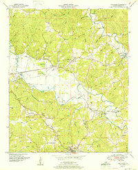
1951 Map of Halltown
USGS Topo · Published 1951About this map
The Freedom Hills define the northern terrain of this Franklin County landscape, giving way to the prominent Tennessee Valley Divide that snakes across the southern portion of the sheet. The Illinois Central Railroad serves as the primary industrial artery, following the lowlands past settlements like Vina and small rail-side features such as Coker Spur. The rural character of the mid-century is evident in the concentration of community landmarks, including Liberty Hill Church and the Community Center Ch near the banks of Bear Creek.
Find a feature on this map
63 named features on this map. Tap any name to fly to it.
Don’t see what you’re looking for? This feature index may not catch every label — zoom into the map to look around manually.
Map Details
Editions of this 1951 Halltown Map
2 editions found
Other maps of this area

1925 · Barton
USGS Topo · 1:62,500

1926 · Barton
USGS Topo · 1:48,000

1929 · Barton
USGS Topo · 1:62,500

1935 · Pleasant Site
USGS Topo · 1:24,000

1936 · Belmont
USGS Topo · 1:24,000

1936 · Pleasant Grove
USGS Topo · 1:24,000

1936 · Hodges
USGS Topo · 1:24,000

1936 · Red Bay
USGS Topo · 1:24,000

1936 · Vina
USGS Topo · 1:24,000

1936 · Halltown
USGS Topo · 1:24,000