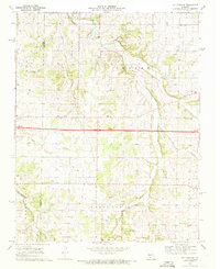
1969 Map of Halltown NE
USGS Topo · Published 1971About this map
The rolling Ozark landscape on the border of Greene and Lawrence counties is bisected by the iconic alignment of highway 44 66 at the end of the 1960s. The village of Halltown serves as a focal point near the western edge, surrounded by family-named landmarks that speak to the area's pioneer genealogy. Small rural communities like Plano are connected by a network of drainage ways including the Sac River, Pickerel Creek, and Turnback Creek.
Find a feature on this map
31 named features on this map. Tap any name to fly to it.
Don’t see what you’re looking for? This feature index may not catch every label — zoom into the map to look around manually.
Map Details
Editions of this 1969 Halltown NE Map
2 editions found
Other maps of this area

1884 · Springfield
USGS Topo · 1:125,000

1886 · Greenfield
USGS Topo · 1:125,000

1886 · Springfield
USGS Topo · 1:125,000

1888 · Greenfield
USGS Topo · 1:125,000

1919 · Halltown
USGS Topo · 1:62,500

1936 · Brookline
USGS Topo · 1:24,000

1948 · Willard
USGS Topo · 1:24,000

1954 · Springfield
USGS Topo · 1:250,000

1956 · Ash Grove
USGS Topo · 1:24,000
1956 · Everton
USGS Topo · 1:24,000