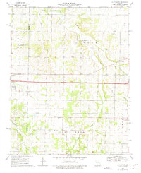
1969 Map of Halltown NE
USGS Topo · Published 1975About this map
The Sac River and its numerous tributaries, including Pickerel Creek and Pond Creek, carve a rolling agricultural landscape along the boundary of Lawrence and Greene counties. At the center of this rural network, Interstate 44 cuts through the territory, passing just south of the settlement of Halltown and the village of Plano. The map reveals a deeply rooted community structure, evidenced by the high density of family-named cemeteries and rural congregations.
Find a feature on this map
31 named features on this map. Tap any name to fly to it.
Don’t see what you’re looking for? This feature index may not catch every label — zoom into the map to look around manually.
Map Details
Editions of this 1969 Halltown NE Map
2 editions found
Other maps of this area

1884 · Springfield
USGS Topo · 1:125,000

1886 · Greenfield
USGS Topo · 1:125,000

1886 · Springfield
USGS Topo · 1:125,000

1888 · Greenfield
USGS Topo · 1:125,000

1919 · Halltown
USGS Topo · 1:62,500

1936 · Brookline
USGS Topo · 1:24,000

1948 · Willard
USGS Topo · 1:24,000

1954 · Springfield
USGS Topo · 1:250,000

1956 · Ash Grove
USGS Topo · 1:24,000
1956 · Everton
USGS Topo · 1:24,000