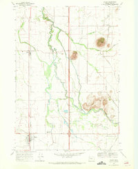
1969 Map of Halsey
USGS Topo · Published 1971About this map
Halsey and Shedd serve as primary hubs along the Southern Pacific railroad corridor in Linn County, highlighting the region's agricultural and transport infrastructure in the late 1960s. The landscape is defined by the winding course of the Calapooia River and a complex network of drainage features like Shedd Slough, Walton Slough, and Spoon Creek.
Find a feature on this map
33 named features on this map. Tap any name to fly to it.
Don’t see what you’re looking for? This feature index may not catch every label — zoom into the map to look around manually.
Map Details
Editions of this 1969 Halsey Map
2 editions found
Other maps of this area

1909 · Harrisburg
USGS Topo · 1:31,680

1909 · Rowland
USGS Topo · 1:31,680

1911 · Brownsville
USGS Topo · 1:31,680

1911 · Lebanon
USGS Topo · 1:31,680

1911 · Tangent
USGS Topo · 1:31,680

1912 · Halsey
USGS Topo · 1:62,500

1913 · Oakville
USGS Topo · 1:31,680

1916 · Albany
USGS Topo · 1:62,500

1921 · Brownsville
USGS Topo · 1:62,500

1921 · Lebanon
USGS Topo · 1:62,500