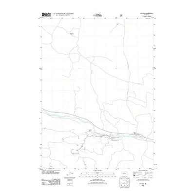
2011 Map of Halsey
USGS Topo · Published 2011About this map
The Middle Loup River winds through this Nebraska landscape, defining the character of the settlement at Halsey. The town is oriented toward the river and the rail corridor, where Burlington St and Railroad St parallel the tracks. This area is a hub for land management and youth recreation, anchored by the Bessey District Ranger Office and the Nebraska State 4H Camp. Public land use is prominent, with the Bessey Recreation Area and Bessey Recreation Complex Campground situated south of the river. Farther into the uplands, the Scott Lookout Tower stands as a landmark for forest observation. The surrounding territory is marked by legacy cattle operations such as the Rodocker Ranch and A L Ranch, connected by rural routes like Purdum Rd.
Find a feature on this map
15 named features on this map. Tap any name to fly to it.
Don’t see what you’re looking for? This feature index may not catch every label — zoom into the map to look around manually.
Map Details
Editions of this 2011 Halsey Map
This is the sole edition of this map. No revisions or reprints were ever made.
Other maps of this area

1948 · Halsey
USGS Topo · 1:62,500

1949 · Purdum
USGS Topo · 1:62,500

1949 · Koshopah
USGS Topo · 1:62,500

1950 · Halsey
USGS Topo · 1:62,500

1951 · Dunning
USGS Topo · 1:62,500

1951 · Purdum
USGS Topo · 1:62,500

1951 · Koshopah
USGS Topo · 1:62,500

1954 · North Platte
USGS Topo · 1:250,000

1956 · North Platte
USGS Topo · 1:250,000

1957 · North Platte
USGS Topo · 1:250,000