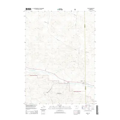
2014 Map of Halsey
USGS Topo · Published 2014About this map
Halsey occupies a strategic position along the northern bank of the Middle Loup River, serving as a gateway to the extensive tracts of the Nebraska National Forest. This 2014 survey captures the distinct transition from the river valley to the undulating Sandhills terrain. The settlement’s core is defined by the intersection of Main St and Railroad St, reflecting a traditional grid layout adjacent to the transportation corridor of Ne-2. To the south, the forest boundaries are accessed via State Hwy Spur S-86B, while the northern uplands are navigated by long, winding ranch roads such as Rosehill Rd and Purdum Ave. The map also illustrates the political geography of the region, specifically the dividing line between Thomas Co and Blaine Co which passes just east of the village.
Find a feature on this map
15 named features on this map. Tap any name to fly to it.
Don’t see what you’re looking for? This feature index may not catch every label — zoom into the map to look around manually.
Map Details
Editions of this 2014 Halsey Map
This is the sole edition of this map. No revisions or reprints were ever made.
Other maps of this area

1948 · Halsey
USGS Topo · 1:62,500

1949 · Purdum
USGS Topo · 1:62,500

1949 · Koshopah
USGS Topo · 1:62,500

1950 · Halsey
USGS Topo · 1:62,500

1951 · Dunning
USGS Topo · 1:62,500

1951 · Purdum
USGS Topo · 1:62,500

1951 · Koshopah
USGS Topo · 1:62,500

1954 · North Platte
USGS Topo · 1:250,000

1956 · North Platte
USGS Topo · 1:250,000

1957 · North Platte
USGS Topo · 1:250,000