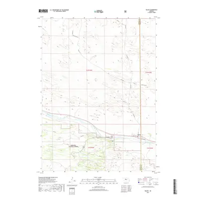
2017 Map of Halsey
USGS Topo · Published 2017About this map
Halsey sits along the northern edge of the Nebraska National Forest, marking a unique transition where the wooded terrain meets the valley of the Middle Loup River. This 2017 survey details the interface between the sprawling forest lands and the local agricultural economy of the Sandhills. The village is positioned at a geographic boundary, straddling the line between Thomas Co and Blaine Co. Evidence of the area's development is visible in the network of local access roads such as Rodocker Ranch Rd and Nursery Admin Rd, which support both the timber industry and ranching operations. The presence of Railroad St and the Spur S-86B highlights the transportation infrastructure that has historically connected this remote portion of central Nebraska to wider markets.
Find a feature on this map
24 named features on this map. Tap any name to fly to it.
Don’t see what you’re looking for? This feature index may not catch every label — zoom into the map to look around manually.
Map Details
Editions of this 2017 Halsey Map
This is the sole edition of this map. No revisions or reprints were ever made.
Other maps of this area

1948 · Halsey
USGS Topo · 1:62,500

1949 · Purdum
USGS Topo · 1:62,500

1949 · Koshopah
USGS Topo · 1:62,500

1950 · Halsey
USGS Topo · 1:62,500

1951 · Dunning
USGS Topo · 1:62,500

1951 · Purdum
USGS Topo · 1:62,500

1951 · Koshopah
USGS Topo · 1:62,500

1954 · North Platte
USGS Topo · 1:250,000

1956 · North Platte
USGS Topo · 1:250,000

1957 · North Platte
USGS Topo · 1:250,000