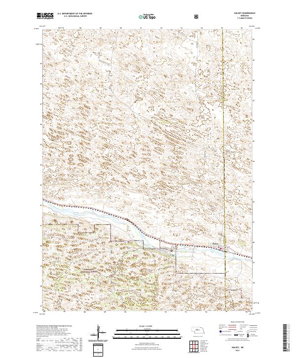
2021 Map of Halsey
USGS Topo · Published 2021About this map
The Middle Loup River meanders through the central Nebraska Sandhills in this modern topography, marking a distinct corridor of vegetation and human activity. Near the intersection of the Thomas and Blaine County lines, the village of Halsey is clustered along the southern bank, where streets like Burlington St and Railroad St reflect its position along the rail corridor. South of the river, the landscape transitions into the Nebraska National Forest, a significant man-made woodland characterized by a network of recreational and administrative paths. Local history and outdoor activity are traced through labels such as the Scott Lookout Trl, Dismal River Trl, and Nursery Admin Rd. Further north, the terrain is dominated by the unique dune geology of the region, accessed by rural routes like Rodocker Ranch Rd and Purdum Ave.
Find a feature on this map
28 named features on this map. Tap any name to fly to it.
Don’t see what you’re looking for? This feature index may not catch every label — zoom into the map to look around manually.
Map Details
Editions of this 2021 Halsey Map
This is the sole edition of this map. No revisions or reprints were ever made.
Other maps of this area

1948 · Halsey
USGS Topo · 1:62,500

1949 · Purdum
USGS Topo · 1:62,500

1949 · Koshopah
USGS Topo · 1:62,500

1950 · Halsey
USGS Topo · 1:62,500

1951 · Dunning
USGS Topo · 1:62,500

1951 · Purdum
USGS Topo · 1:62,500

1951 · Koshopah
USGS Topo · 1:62,500

1954 · North Platte
USGS Topo · 1:250,000

1956 · North Platte
USGS Topo · 1:250,000

1957 · North Platte
USGS Topo · 1:250,000