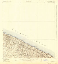
1915 Map of Hamakua
USGS Topo · Published 1943About this map
Sugar cane cultivation and coastal commerce dominate this topographical survey of Hawaii's northern coast. The landscape is defined by its industrial infrastructure, from the Honokaa Mill and Paauhau Mill to the specialized Louisson Coffee Mill further inland. These processing centers are linked to the sea by a series of critical maritime nodes, including Honokaa Landing and Ookala Landing, where goods were moved along the precipitous shoreline.
Find a feature on this map
42 named features on this map. Tap any name to fly to it.
Don’t see what you’re looking for? This feature index may not catch every label — zoom into the map to look around manually.
Map Details
Editions of this 1915 Hamakua Map
3 editions found
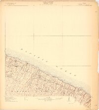
Other maps of this area

1915 · Hamakua
USGS Topo · 1:62,500

1915 · Honomu
USGS Topo · 1:62,500

1916 · Waipio
USGS Topo · 1:62,500

1954 · Hawaii North
USGS Topo · 1:250,000

1956 · Keanakolu
USGS Topo · 1:24,000

1956 · Makahalau
USGS Topo · 1:24,000

1956 · Umikoa
USGS Topo · 1:24,000

1957 · Kukaiau
USGS Topo · 1:24,000

1957 · Honokaa
USGS Topo · 1:24,000

1959 · Hawaii North
USGS Topo · 1:250,000