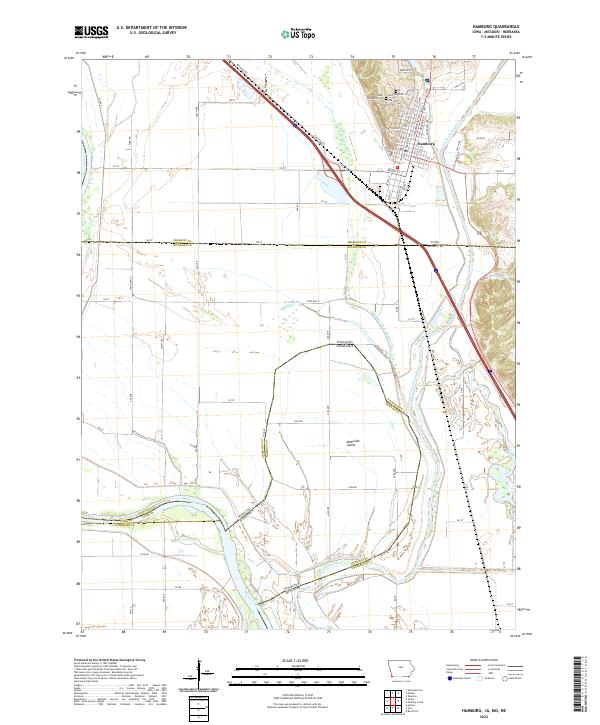
2022 Map of Hamburg
USGS Topo · Published 2022About this map
The town of Hamburg sits at the junction of intricate water systems and shifting state lines where Iowa, Missouri, and Nebraska converge. The landscape is defined by the sweeping curves of the Missouri River and the Nishnabotna River, along with a complex network of man-made waterways like the Iowa Drainage Ditch and Main Ditch Number Six. These drainage works reflect a long history of reclaiming the fertile bottomlands for agriculture. On the Nebraska side, the distinctive McKissick Island serves as a geographic curiosity—land physically separated by the river's path but maintaining its original political affiliation. Local history and genealogy are centered on the north side of town at Saint Marys Cem and the Hamburg Cem, while the surrounding rural grid is documented by a dense system of local roads such as Railroad Rd and Farm Rd.
Find a feature on this map
80 named features on this map. Tap any name to fly to it.
Don’t see what you’re looking for? This feature index may not catch every label — zoom into the map to look around manually.
Map Details
Editions of this 2022 Hamburg Map
This is the sole edition of this map. No revisions or reprints were ever made.
Other maps of this area

1907 · Nebraska City
USGS Topo · 1:62,500

1915 · Nemaha
USGS Topo · 1:62,500

1915 · Howe
USGS Topo · 1:62,500

1939 · Hamburg
USGS Topo · 1:62,500

1939 · Nemaha
USGS Topo · 1:62,500

1941 · Hamburg
USGS Topo · 1:62,500

1949 · Nemaha
USGS Topo · 1:62,500

1955 · Nebraska City
USGS Topo · 1:250,000

1957 · Nebraska City
USGS Topo · 1:250,000

1958 · Nebraska City
USGS Topo · 1:250,000