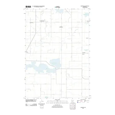
2010 Map of Hamburg
USGS Topo · Published 2010About this map
Hamburg serves as the primary hub in this Carver County landscape, centered around its local infrastructure including the Hamburg Post Office. The surrounding agricultural countryside is defined by a dense network of country roads and several significant water bodies, most notably Washington Lake and Erin Lake to the south. The area’s spiritual and genealogical history is well-preserved through numerous burial grounds, such as the Emanuel Lutheran Church Cemetery and Saint Paul's Evangelical Reformed Church Cemetery, which anchor the small crossroads communities. Near the eastern edge, the settlement of Assumption remains a distinct point of interest with its own Assumption Cemetery. This survey illustrates a rural Minnesota township where historical family plots like the Bovy Family Cemetery and small lake basins like Silver Lake and Hoeffken Lake have long dictated the placement of farms and thoroughfares.
Find a feature on this map
47 named features on this map. Tap any name to fly to it.
Don’t see what you’re looking for? This feature index may not catch every label — zoom into the map to look around manually.
Map Details
Editions of this 2010 Hamburg Map
This is the sole edition of this map. No revisions or reprints were ever made.
Other maps of this area

1953 · Saint Paul
USGS Topo · 1:250,000

1953 · New Ulm
USGS Topo · 1:250,000

1957 · New Ulm
USGS Topo · 1:250,000

1957 · Belle Plaine
USGS Topo · 1:62,500

1957 · Waconia
USGS Topo · 1:62,500

1958 · New Ulm
USGS Topo · 1:250,000

1958 · Gaylord
USGS Topo · 1:62,500

1958 · Glencoe
USGS Topo · 1:62,500

1959 · Saint Paul
USGS Topo · 1:250,000

1967 · New Ulm
USGS Topo · 1:250,000